Description (0)
| Anchorage Facts |
| Depth |
3 meters |
| Bottom Type |
Sand |
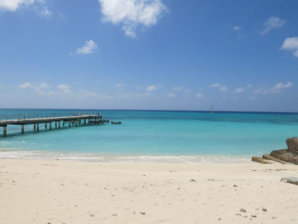
This lee anchorage is right off the town, near the big radio tower. When southerly winds are blowing or there is swell, you'll really feel it here. Work you way in toward shore using eyeball navigation as far as you feel comfortable and be aware that the bottom has rock rubble, some shallow sand with ledge underneath and probably some decent sandy spots. It took us 3 tries to feel comfortable with the holding (it was pretty windy so we needed to be sure it was well set) and we anchored in 10 feet, could have gone in closer to the piers. The 2 piers are in total disrepair and only good to tie your dinghy to and then carefully walk on the remaining wood planks to get ashore. The National Museum is right on the ocean facing street, just off the pier. Only open on cruise ship days. Form town you can walk to the northern lighthouse almost all on sidewalk/bike path. Unfortunately, the lighthouse is not in great shape and its only open on cruise ship days. You can scuba dive from here using a dive shop or on your own. There are mooring buoys all up & down the coast including within easy dinghy distance from the anchorage. The Bohio Resort restaurant is supposedly pretty good.
Features
-

-

-

-
 The Dominican Supermarket is less expensive than others
-

-

Reviews
Be the first to add a review!
Nearby Places(to show the Places layer, click the layer button in the top right corner of the map)
Be the first to add a Place!
Nearby Markers (to show the Nearby Markers layer, click the layer button in the top right corner of the map)
|
-
 View of Cockburn Town from anchorage
 Cockburn Town Anchorage
|


