Wilkes Pass Drift Dive

  • 17º 50.560 S 177º 10.632 E
Created on 2017-05-27 00:00:00.0
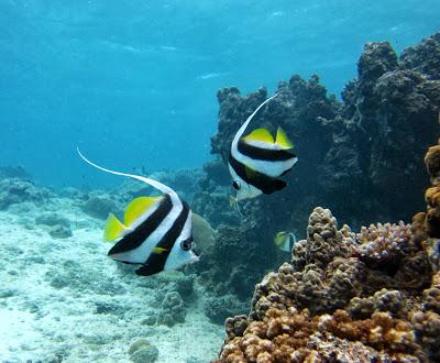
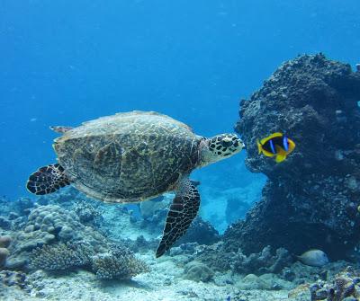
Description
 (0)

This is a drift dive and you need to plan for current. Great fish life! If the weather is calm and you have a fast dingy you can leave the boat in the Musket Cove anchorage.

Features
  • This is a pass so plan the tides.
Reviews
Be the first to add a review!
Nearby Places(to show the Places layer, click the layer button in the top right corner of the map)
Be the first to add a Place!
Nearby Markers (to show the Nearby Markers layer, click the layer button in the top right corner of the map)
Namotu Island
2.75nm on a course of 83 E
namotu-island-n
0.41nm on a course of 86 E
tavarua-island-n
1.68nm on a course of 113 ESE
Route To Musket Cove
4.01nm on a course of 52 NE
cloud-nine
3.63nm on a course of 325 NW
Mamanutha Islands
4.04nm on a course of 2 N
malolo-island
4.19nm on a course of 6 N
Musket Cove 4.3nm on a course of 8 N
Musket Cove Mooring
4.39nm on a course of 10 N
Momi Bay
4.53nm on a course of 120 ESE
vunabaka
5.21nm on a course of 345 NNW
Tropical Resort Anchorage 5.55nm on a course of 345 NNW
malolo-barrier-reef
6.25nm on a course of 315 NW
Momi Bay 2
6.76nm on a course of 132 SE
casteaway-island-resort
7.34nm on a course of 335 NNW
Malamala to Vuda Point
8.77nm on a course of 41 NE
Mana Island
9.59nm on a course of 341 NNW
mana-island-lagoon-south-end
10.45nm on a course of 338 NNW
mana-island-lagoon-north-end
10.69nm on a course of 337 NNW
B26 Bomber Wreck 11.42nm on a course of 21 NNE
Port Denarau
11.24nm on a course of 67 ENE
Beachcomber 11.93nm on a course of 21 NNE
yakuilau-island-south
11.61nm on a course of 66 ENE
yakuilau-island-east
11.99nm on a course of 66 ENE
Port Denarau Marina 12.39nm on a course of 70 ENE
port-denarau
12.45nm on a course of 70 ENE
port-denarau-outer-anchorage
13.02nm on a course of 67 ENE
nadi-cyclone-gunkhole
13.04nm on a course of 71 ENE
Salamanda Wreck 13.97nm on a course of 12 NNE
Likuri Island
14.04nm on a course of 154 SSE
robinson-crusoe-island
14.13nm on a course of 153 SSE
vuda-point-marina-submersed-object-near-quarantine-ball
14.99nm on a course of 51 NE
vuda-point
15.33nm on a course of 51 NE
yanuya-w
16.07nm on a course of 337 NNW
yanuya-island
16.12nm on a course of 335 NNW
Monoriki NE Sand Spit
16.13nm on a course of 331 NNW
monuriki-island
16.14nm on a course of 331 NNW
monuriki
16.17nm on a course of 331 NNW
saweni-bay-0
17.12nm on a course of 46 NE
saweni-bay
17.19nm on a course of 46 NE
mbekana-island
21.45nm on a course of 46 NE
cuvu-harbor
22.12nm on a course of 143 SE
viti-levu-s-cuvu-harbor
22.4nm on a course of 142 SE
Volivoli to Lautoka
66.54nm on a course of 61 ENE
Lautoka
22.58nm on a course of 46 NE
cyclone-hole-lautoka
22.69nm on a course of 48 NE
navadra-shallow-anchorage
24.19nm on a course of 342 NNW
navadra-island-vanua-levu-island
24.36nm on a course of 342 NNW
navadra-island-w-coast
24.47nm on a course of 342 NNW
vitogo-bay
24.16nm on a course of 46 NE
korovunatoto-west-coast
26.08nm on a course of 45 NE
Yasawa Group
27.46nm on a course of 351 N
nathilau-point
27.42nm on a course of 44 NE
FAQ About Us Contact Terms Of Service Privacy Policy