Description (0)
| Anchorage Facts |
| Depth |
7 meters |
| Bottom Type |
Sand |
Lady Musgrave Island is part of the
Bunker Group and lies about 55 miles from Bundaberg & 35 miles
from Bustard Head. It is a navigable coral lagoon with one inlet, an
island and clear water. Entry is made through a marked channel on the
NW side of the reef. In 2015 it was marked by a pair of red &
green marks at the entrance, followed by another green inside that
you leave to starboard before turning sharply to starboard to avoid
an isolated danger mark on a bommie right in the middle of the
channel once inside. There was even a white arrow on the center
channel bommie guiding you starboard to avoid it. Then head toward
the island & anchorage, avoiding any bommies on the way. The
anchorage is large and there are plenty of sandy spots to drop the
hook in 20-30 feet. There is a marked dinghy channel to get ashore
where there is a walking trail, campground & informational signs.
The water colors are beautiful and there are lots of birds. In the
pictures uploaded here, there is a copy of one of the info signs
showing the areas listed for good snorkeling & diving. We dove
the NW outer pass and found it to be just average and only about 25
feet.
Features
-

-
 Short trail crossing island
Reviews
Be the first to add a review!
Nearby Places(to show the Places layer, click the layer button in the top right corner of the map)
Be the first to add a Place!
Nearby Markers (to show the Nearby Markers layer, click the layer button in the top right corner of the map)
|
-
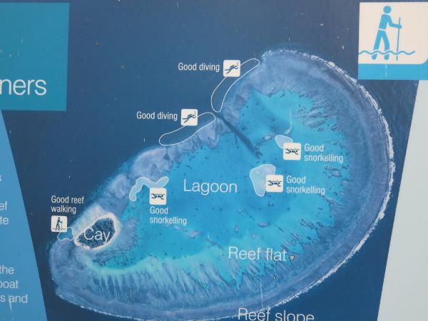 Map of Lady Musgrave snorkeling & scuba sites
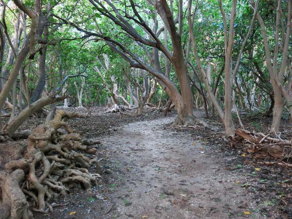 Inland trail on Lady Musgrave Island
 Beach view on Lady Musgrave
|


