Description (0)
| Anchorage Facts |
| Depth |
6 meters |
| Bottom Type |
Mud |
Horseshoe Bay is the most protected and
popular anchorage for Magnetic Island. Protected from E-SW winds.
Easy to enter and choose depth for anchoring in approx 12-20 feet in
sandy mud. Commonly used for nighttime arrivals since the approach
and entry is clear of underwater hazards. Beach the dinghy for shore
access. There are bathrooms & water faucets, rubbish bins.
Horseshoe Bay is a relaxed tourist strip with lodging, restaurants
and hiking trails that go to other bays and island towns. There is
bus service, a wildlife/koala park and watersports opportunities.
Long beach for walking. Magnetic Island National Park has a wonderful
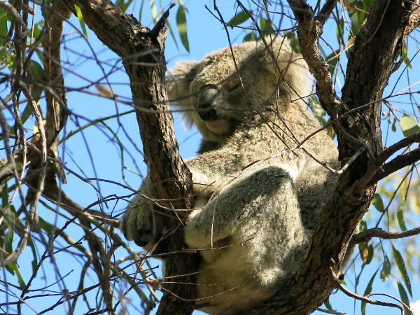
"Forts Trail" showcasing the remains of WWII forts on hilly
terrain and supports a large colony of koalas. We saw 7 koalas from
the trail. There is a marina in Nelly Bay which is on the SE side of
Magnetic Island. Picnic Bay is where the ferries arrive & depart
for nearby Townsville and there is a PO and a grocery store in the
town of Arcadia which is near Nelly Bay. Magnetic Island was named by
Captain James Cook who noted compass anomalies while exploring the
area.
Features
-

-
 Nice long beach of reddish brown sand
-
 There is gas on the island, but not in the bay.
-

-
 Tourist shops in the bay, groceries in Nelly Bay
Reviews
Be the first to add a review!
Nearby Places(to show the Places layer, click the layer button in the top right corner of the map)
Be the first to add a Place!
Nearby Markers (to show the Nearby Markers layer, click the layer button in the top right corner of the map)
|
-
 Forts Trail Wildlife
 Horseshoe Bay
 Koalas on the Forts Trail
|


