Description (0)
| Anchorage Facts |
| Depth |
6 meters |
| Bottom Type |
Sand |
This harbor is part of the AMP Marine Reserve (Area Marina Protetta) and is Zone B. This means anchoring could be prohibited but when we were here, there were loads of boats anchored outside the breakwaters. Inside the breakwaters was full of small local fishing boats. Good protection from all but southerly, SE winds. Good holding on sand. Easy to tie the dinghy inside the harbor to a seawall. The town is pretty, colorful and there are restaurants and shops there. You can walk uphill to the fort which isn't presented as a tourist attraction but there is a belvedere on top- just follow the signs. There are also a couple of old churches.
Features
Reviews
Be the first to add a review!
Nearby Places(to show the Places layer, click the layer button in the top right corner of the map)
Be the first to add a Place!
Nearby Markers (to show the Nearby Markers layer, click the layer button in the top right corner of the map)
|
-
 Colorful Cala di Corricella town
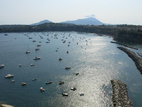 The anchorage area
|


