Description (0)
| Anchorage Facts |
| Depth |
8 meters |
| Bottom Type |
Sand |
On the SE side of Malta, just north of Marsaxlokk and just south of St Thomas Bay, the coastline is full of indentations among the white cliffs that offer some beautiful anchorages as long as the weather is calm. Or you could do a day trip as many local tourist boats do. The swimming is great, there is a natural arch and many caves to explore. You will see tourists on shore who have arrived by trail to the popular St Peters Pool, a swimming spot, but there are many other more secluded places just nearby to choose from. Choose your depth and spot to drop the hook.
Reviews
Be the first to add a review!
Nearby Places(to show the Places layer, click the layer button in the top right corner of the map)
Nearby Markers (to show the Nearby Markers layer, click the layer button in the top right corner of the map)
|
-
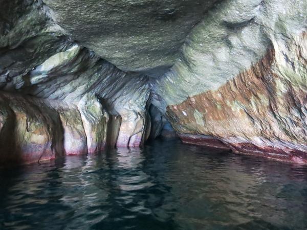 One of the caves on SE Malta
 Great formations in St Peters Pool Vicinity
|


