Description (0)
| Anchorage Facts |
| Depth |
3 meters |
| Bottom Type |
Sand |
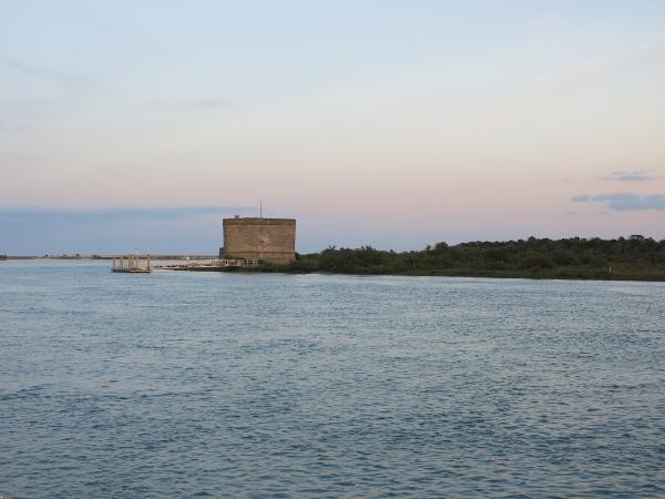
This is a pleasant anchorage just off the ICW in front of the historic Matanzas Fort. In looking at the chart, you'll see that when entering the anchorage channel from the ICW, the water at the entrance is deeper to the north end than the south. Inside, the water shoals once you're about even with the fort but prior to that it is approx 10 feet. Good holding in sand. A lot of current runs through here but the anchorage is snug. At the time of this writing, the fort is closed to the public. The visitors center and park office is just across from the fort . They close around 5pm.
Features
-
 There is a great beach across from the fort toward the Matanzas inlet and around to the ocean side.
-
 Cellular data service
Reviews
Be the first to add a review!
Helpful Links
Nearby Places(to show the Places layer, click the layer button in the top right corner of the map)
Be the first to add a Place!
Nearby Markers (to show the Nearby Markers layer, click the layer button in the top right corner of the map)
|
|