Description (0)
Koh Miang is #4 of the Similan Islands
and is one of the two park headquarters (the other one is on island #8). There is a park office, facilities,
campground, restaurant and some trails on shore. There are
several moorings to choose from on the north, east and southern tip of the island. Many day boats come here as well as liveaboard dive boats but the mooring turnover is pretty good. The water is lovely
and the beach is fine white sand. There are 3 trails: one goes to
Sunset Point through a bamboo forest and the other up many ladders &
ropes to a large boulder lookout and the last one to a beach on the
eastern side. All are well maintained. There is decent snorkeling
off the rock grouping just to the east of the island and there are
more moorings to choose from over there. You can scuba dive around here.
Soft corals, sea fans and reef cruiser fish make it interesting. Ask the dive boats for advice on where to go or look online since there are plenty of dive websites for the Similans.
Reviews
Be the first to add a review!
Nearby Places(to show the Places layer, click the layer button in the top right corner of the map)
Be the first to add a Place!
Nearby Markers (to show the Nearby Markers layer, click the layer button in the top right corner of the map)
|
-
 An affectionate pair of squid
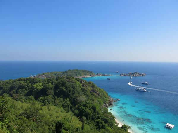 View from the lookout trail
|


