Description (0)
| Anchorage Facts |
| Depth |
6 meters |
| Bottom Type |
Mud |
If passing through this area, you wouldn't want to miss visiting Cumberland Island National Park & Seashore. Plus, there is a really nice anchorage in Cumberland Sound to keep your boat while you tour around. Headed north, bear off the ICW into Cumberland Sound after Red buoy 32 and follow the deep water up to the second NPS dock at "Seacamp". This dock is the next dock after the one with the white building on shore. You can anchor off the dock or just beyond as the water shallows. Remember there is 10 feet of tide and a strong current runs through. Put the dinghy on the backside of the dock. The park office, maps, pay station ($10/person for 1 week) and all the lovely trails and ruin sites are right ashore from the anchorage. Look for deer, armadillos, wild horses, lots of birds, beautiful old trees and very few cars & people. This place is a real gem.
Features
-
 Miles of beach to walk on the ocean side
-
 good cellular data here
-
 You can rent bikes at the ranger station at the dinghy dock
-
 Lots of trails and historic sites. Free tours of the Plum Orchard mansion too
Reviews
Be the first to add a review!
Helpful Links
Nearby Places(to show the Places layer, click the layer button in the top right corner of the map)
Be the first to add a Place!
Nearby Markers (to show the Nearby Markers layer, click the layer button in the top right corner of the map)
|
-
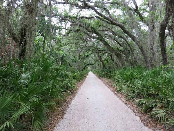 Quiet sand road goes for miles
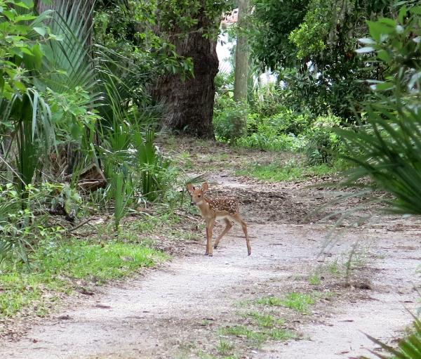 Fawn with mom nearby
 Dungeness Ruins from the Canergie's
|


