Description (0)
| Anchorage Facts |
| Depth |
4 meters |
| Bottom Type |
Mud |
Area is well protected from Lake Michigan except in south-southeast winds. Depth is about 15'. Bottom is soft mud which held well for me with light winds that night.
Shore directly to the west is city park and vacant land (former steel mill). Industry and Hammond Horseshoe Casino dominates the south including northwest Indiana steel mills.
Fuel and pump-out are available at the Hammond marine about 3.5 miles south.
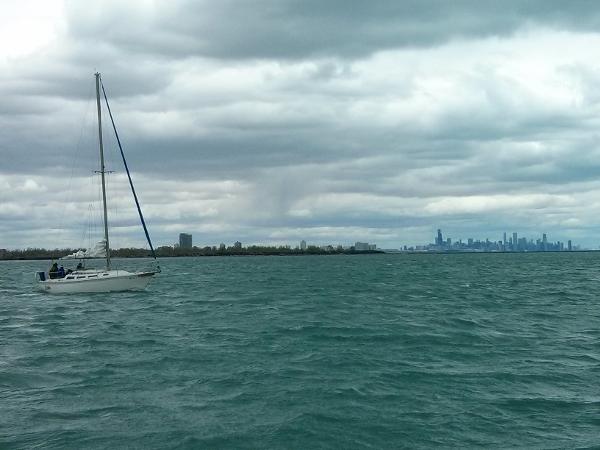
Picture was taken in May, 2016 about 1/2 mile southeast and shows the area where I anchored. The shore has changed little since taken.
Reviews
Be the first to add a review!
Nearby Places(to show the Places layer, click the layer button in the top right corner of the map)
Be the first to add a Place!
Nearby Markers (to show the Nearby Markers layer, click the layer button in the top right corner of the map)
|
-
 Calumet Harbor
View from main break wall entrance looking northwest on a blustery May day with Chicago skyline in the distance.
|


