Description (0)
| Anchorage Facts |
| Depth |
10 meters |
| Bottom Type |
Sand |
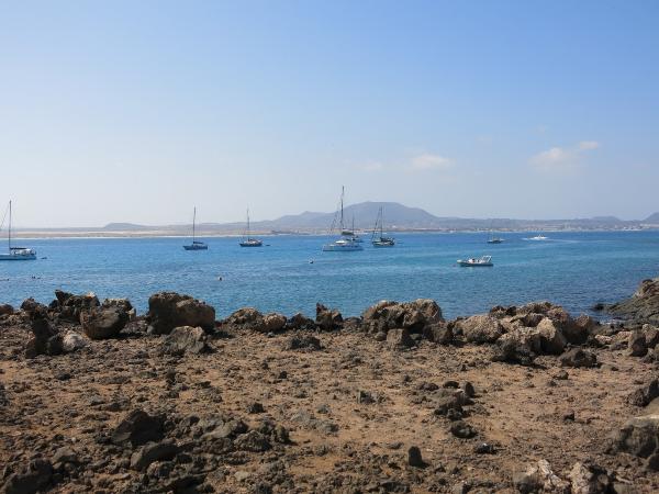
This small island just 2 miles from the north end of Fuerteventura is set aside as a park and popular with day-trippers. It is named for the monk seals that used to call this place home, many years ago. There is a decent anchorage that holds lots of boats in settled NE winds. We were here in 20kt NE winds and close to 2m NW swell and it was still OK but not as fun! Great holding in pure white sand. Dinghy around the SE side of the island from the anchorage weaving through the rocks to find a nice cove and protected pool where the locals keep their boats and the smaller tour boats ferry passengers in & out. There is a restaurant there, a park visitor center and access to walking trails. Trails head to a crescent shaped beach, a lighthouse, old salt pans, and up to the summit of the caldera. The water is a beautiful color and you can snorkel here.
Features
-

-
 Park trails circle the island & go up the caldera summit
Reviews
Be the first to add a review!
Nearby Places(to show the Places layer, click the layer button in the top right corner of the map)
Be the first to add a Place!
Nearby Markers (to show the Nearby Markers layer, click the layer button in the top right corner of the map)
|
|