Description (0)
| Anchorage Facts |
| Depth |
5 meters |
| Bottom Type |
Sand |
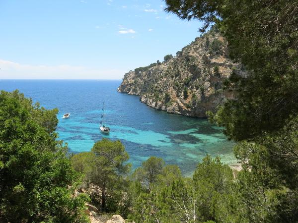
This is a really pretty anchorage with great protection from west through east. Holding is excellent in sand however you cannot penetrate too far in as there are rock ledges and tufts of grass covered rocks, easily seen. At the head of the cala is a rocky beach with a steep trail to a parking lot & the road. This beach is dog friendly and has no facilities so only a few people come to it. You can walk in to Camp de Mar which takes about 45 minutes. Although there is a housing development above the cala, it still is very attractive with high cliffs and colorful water.
Features
Reviews
Be the first to add a review!
Nearby Places(to show the Places layer, click the layer button in the top right corner of the map)
Be the first to add a Place!
Nearby Markers (to show the Nearby Markers layer, click the layer button in the top right corner of the map)
|
-
 Cala Blanca Anchorage
 Distant view of Cala Blanca
|


