Description (1)
| POI Facts |
| Bottom Type |
Unknown |
This island, part of the barrier that makes up the Faro and Olhao lagoon, is an interesting one to visit. It is both a fishing village and a laid back summer tourist spot. It is OK to land the dinghy in the fisherman's marina area and there is a boardwalk leading to the ocean side beach. There are two separate villages- one out on the point and one near this marker. You could walk across the island on the boardwalk and then up to the lighthouse to see the other village. There are a few beach restaurants to compliment the sand roads that are fun to stroll on.
Reviews
"iutlti"
Reviewed on 2021-05-27 00:00:00.0
tikutku
Add a Review
Nearby Places(to show the Places layer, click the layer button in the top right corner of the map)
Nearby Markers (to show the Nearby Markers layer, click the layer button in the top right corner of the map)
|
-
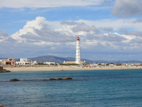 Ocean side view of Culatra Island from the breakwater
 Sandy pedestrian paths are all that is on the island
|