Description (0)
This was a really pretty spot but the beachfront trees were heavily damaged in the hurricanes and the onshore facilities of campground and watersports rental were destroyed. There are still park moorings to pick up and the water is still really clear and pretty. You can get better wind and swell protection in neighboring Francis Bay. One thing that is worth checking out is the Cinnamon Bay Plantation Ruins right across the road from the beach. They have interpretative signs a short path to follow explaining the local flora and history of the place.
Reviews
Be the first to add a review!
Nearby Places(to show the Places layer, click the layer button in the top right corner of the map)
Be the first to add a Place!
Nearby Markers (to show the Nearby Markers layer, click the layer button in the top right corner of the map)
|
-
 Cinnamon Bay Plantation Ruins
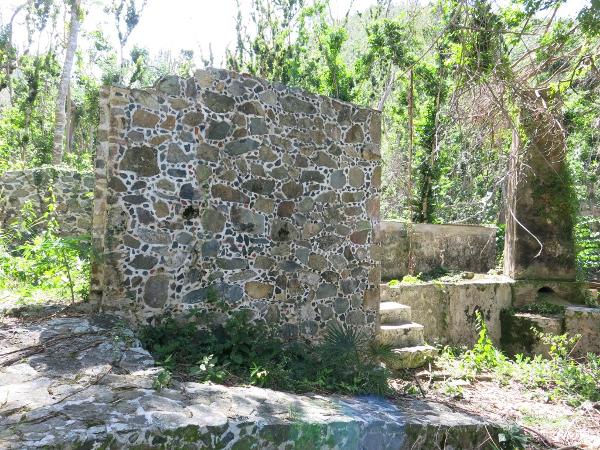 These interesting ruins are just out to the road from the beach
|


