


Hassel Island
| ||||||||||||||||||||||||||||||||||||||||||||||||||||||||||||||

Created on 2018-02-27 00:00:00.0
|
Description (0)
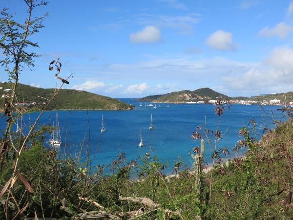
You can anchor on the NW side of Hassel Island and zip over to Crown Bay Marina to do errands if you have a decent dinghy. The northern side of Water Island at Sandy Point is full of private moorings and there isn't much room to anchor. Holding is good in sand and there is decent wind protection but some southerly swell does reach in. Crown Bay Marina has a free dinghy dock and there is laundry, a large Pueblo grocery store close by, a fuel dock. Hassel Island itself is mostly owned by the National Park Service but apparently there is no funding so it is not recommended to visit. Trails are not clear and the island is full of trash. Features
ReviewsBe the first to add a review!Nearby Places(to show the Places layer, click the layer button in the top right corner of the map)Be the first to add a Place!Nearby Markers (to show the Nearby Markers layer, click the layer button in the top right corner of the map)
|
|
||||||||||||||||||||||||||||||||||||||||||||||||||||||||||||


| FAQ | About Us | Contact | Terms Of Service | Privacy Policy |