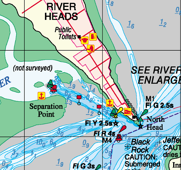
River Heads

  • 25º 25.728 S 152º 55.193 E
Created on 2020-09-10 00:00:00.0
Description
 (0)
Anchorage Facts
Depth meters
Bottom Type Mud

Ok for a night or two, strong tides and whirlpools on the way in on the point.

Features
Reviews
Be the first to add a review!
Nearby Places(to show the Places layer, click the layer button in the top right corner of the map)
Be the first to add a Place!
Nearby Markers (to show the Nearby Markers layer, click the layer button in the top right corner of the map)
Wanggoolba Creek
3.81nm on a course of 103 ESE
South White Cliffs
6.38nm on a course of 155 SSE
Yankee Jack 6.43nm on a course of 157 SSE
Kinfisher Bay Resort Fraser Island 6.6nm on a course of 65 ENE
South Point 6.98nm on a course of 31 NNE
Urangan Boat Harbour 7.89nm on a course of 355 N
Big Woody 7.86nm on a course of 29 NNE
Garry's Anchorage 12.37nm on a course of 166 SSE
Garys Anchorage 12.41nm on a course of 167 SSE
Moon Point
16.2nm on a course of 21 NNE
Browns Gutter 19.75nm on a course of 166 SSE
Bluff Reef
21.63nm on a course of 167 SSE
Kauri Creek Anchorage
22.4nm on a course of 172 S
big mick
22.94nm on a course of 167 SSE
Pelican Bay, Inskip Point 24.09nm on a course of 164 SSE
bullock point anchorage 25.12nm on a course of 163 SSE
Teebar Ck
26.87nm on a course of 169 SSE
Coast Guard Tin Can Bay
28.82nm on a course of 170 S
Luxury Afloat Houseboats, Cafe and Dolphin feeding
28.83nm on a course of 170 S
Tin Can Bay 28.91nm on a course of 168 SSE
TCB Marina 29.06nm on a course of 171 S
Carlo Point 29.12nm on a course of 166 SSE
Lady Woodward
29.56nm on a course of 170 S
FAQ About Us Contact Terms Of Service Privacy Policy