Description (0)
| Anchorage Facts |
| Depth |
4 meters |
| Bottom Type |
Sand |
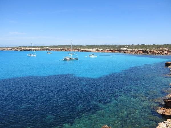
The color of the water in this cala is a gorgeous blue and is crystal clear sand with great holding. It is quite spacious and there is a sandy beach at the head dominated by a resort. You have to anchor outside the yellow swim buoys but you can pick your depth on the gentle slope starting at around 10 feet and up. Good protection except from the west through north. There are fishermen's shacks on the right side of the harbor and we used this area to tie the dinghy. Ashore there are walking paths out to the point and access to the network of bike paths on the island.
Features
-

-

-
 There is a a little store associated with the resort, more like a gift shop.
-

-

Reviews
Be the first to add a review!
Nearby Places(to show the Places layer, click the layer button in the top right corner of the map)
Be the first to add a Place!
Nearby Markers (to show the Nearby Markers layer, click the layer button in the top right corner of the map)
|
-
 Cala Sahona Anchorage
 Boat anchored lee side of Punta Rasa, south of Cala Sahona
|


