Description (0)
| Anchorage Facts |
| Depth |
10 meters |
| Bottom Type |
Sand |
This is a possible anchorage with high cliffs and an old fort as a backdrop. It is open to the south & SE as well as to ocean swell but nonetheless, offers some shelter. While it can be difficult to get ashore here, there is a rock path leading down to the water from the fort. The fort is small but free of charge and offers a green grass courtyard of sorts and pretty views and the main road passes just in front of it with space for pedestrians on the side. It isn't too long of a walk out to the lighthouse.
Reviews
Be the first to add a review!
Nearby Places(to show the Places layer, click the layer button in the top right corner of the map)
Be the first to add a Place!
Nearby Markers (to show the Nearby Markers layer, click the layer button in the top right corner of the map)
|
-
 View of the cliffs in the anchorage
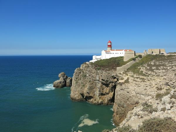 Cabo de Sao Vicente Lighthouse
|


