Description (0)
Marking the southwesternmost point of Europe (reportedly), this lighthouse standing on the point also marks a change in cruising from the higher winds & seas of the rugged western coastline to the calmer waters and beaches of Portugal's Algarve region. It is a popular tourist spot but in actuality, there isn't a lot to do here other than look at the lighthouse and the cliffs stretching off into the distance. Even so, it is nice to see and stand on this point. There is a small museum, a cafe, and various "cowpaths" to meander the cliff area. The public bus comes here or you can walk along the side of the road from the anchorages in the area.
Reviews
Be the first to add a review!
Nearby Places(to show the Places layer, click the layer button in the top right corner of the map)
Be the first to add a Place!
Nearby Markers (to show the Nearby Markers layer, click the layer button in the top right corner of the map)
|
-
 A great sculpture in the cafe area
It shows how octopus are commercially fished for in Portugal by using clay pots.
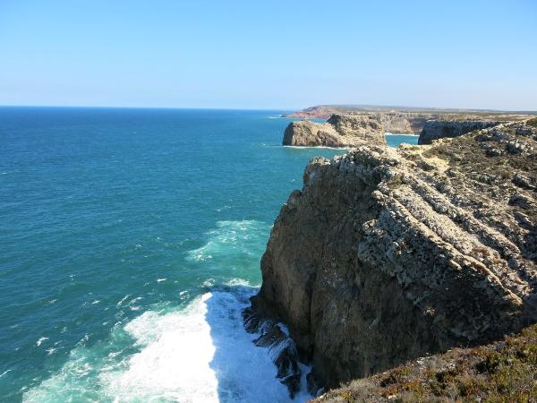 View of the cliffs from Cabo de Sao Vicente
|


