Description (0)
| Anchorage Facts |
| Depth |
8 meters |
| Bottom Type |
Sand |
6°42.046N, 99°38.480E
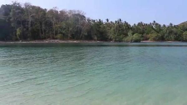
Anchor southwest of the rock outcrop in 6-10 metres on a sandy bottom or just north of the creek entrance tripod marker. Alternatively pick up one of the many government moorings. National Park headquarters has a cement pier at the entrance to the mangrove creek for shallow-draft vessels. A 500 baht per person landing fee will be levied. The mangrove creek, which extends several kilometres and is navigable by dinghy at mid to high tide, runs through a stunning limestone cave (Crocodile Cave). The cave trip is less crowded than Tham Morakot and is a must see. Sea turtle nursing ponds built to raise hatchlings of endangered species stand at the entrance to the park administration building. Other amenities include bamboo houses, bungalows, a small store, restaurant, museum, visitors’ centre, communications office, public toilets and a library. Just south of the settlement is the island’s oldest road, built in 1937, running 11 kilometres to Ao Talo Wao and a further eight kilometres to Ao Talo Udung. A branch track goes to Ao Son on the west coast. All are recommended trekking paths from the main campground area and pass by waterfalls in the hills.
Features
Reviews
Be the first to add a review!
Nearby Places(to show the Places layer, click the layer button in the top right corner of the map)
Be the first to add a Place!
Nearby Markers (to show the Nearby Markers layer, click the layer button in the top right corner of the map)
|
-
 AoPanteAnchorage
|


