


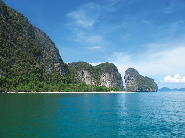
Ko Liang Nua
| ||||||||||||||||||||||||||||||||||||||||||||||||||||||||

Created on 2021-10-23 00:00:00.0
|
Description (0)
007deg 06.9min N 099deg 25.8min E Pass between the two islands from the West staying in the middle of the channel. Anchor in the deep water in 8 to 10 metres and be careful of the reefs on the East side of both islands where the depth will decrease suddenly. This anchorage is suitable in the Southwest season only. No restaurants. FeaturesReviewsBe the first to add a review!Nearby Places(to show the Places layer, click the layer button in the top right corner of the map)Be the first to add a Place!Nearby Markers (to show the Nearby Markers layer, click the layer button in the top right corner of the map)
|
|
||||||||||||||||||||||||||||||||||||||||||||||||||||||


| FAQ | About Us | Contact | Terms Of Service | Privacy Policy |