


Espiritu Santo - Palikulo Bay
| |||||||||||||||||||||||||||||||||||||||||||||||||||||||

Created on 2017-08-30 00:00:00.0
|
Description (0)
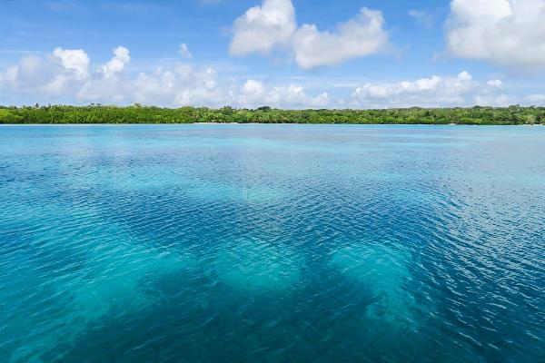
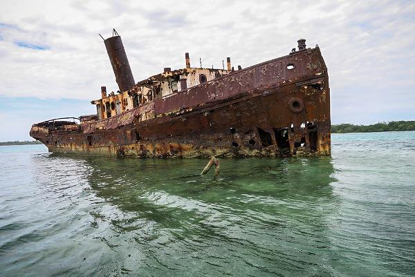
This is a really pretty anchorage with lots of room. We anchored in the inner bay in about 6 meters. The "pass" to get in here isn't bad - we saw about 4 meters at the shallowest point. There are a couple of very photogenic wrecks around the bay, mostly above water. There are also a couple of pretty sand beaches. The snorkeling was just OK, but still fun.
ReviewsBe the first to add a review!Nearby Places(to show the Places layer, click the layer button in the top right corner of the map)
Nearby Markers (to show the Nearby Markers layer, click the layer button in the top right corner of the map)
|
|
|||||||||||||||||||||||||||||||||||||||||||||||||||||


| FAQ | About Us | Contact | Terms Of Service | Privacy Policy |