


Trace des Caps
|

Created on 2018-01-14 00:00:00.0
|
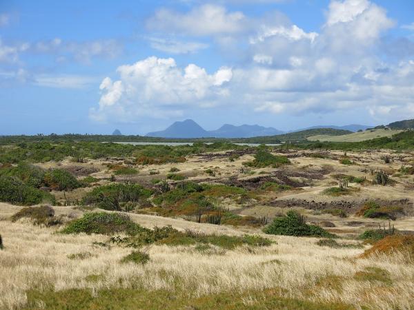
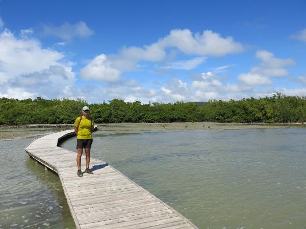
Description (0)A 39km coastal trail trail starts from the town of St Anne and runs all the way around the tip and up the eastern side of the island. You don't have to do all of it! It is well marked and flat, running past numerous beaches and natural areas with picnic tables and rubbish disposal. Lots of shade too. Some coves have road access that bring tourists by car and therefore there are beachside restaurants and gift shops, ice cream and smoothie stands. If you want to make a 6 hour loop you can take leave the trail at the head of Baie des Anglais on the dirt road that heads west. It eventually turns to pavement and then goes back to St Anne. You have to walk 300 meters alongside the main highway before a bike path starts leading to the center of St Anne. This is a really nice walk. Wear good shoes and if it has been rainy expect some mud on the trail. Bring plenty of water. If you get to a tourist office pick up a hiking trail map of Martinique that shows this and other hikes on the island very well. ReviewsBe the first to add a review!Nearby Places(to show the Places layer, click the layer button in the top right corner of the map)
Nearby Markers (to show the Nearby Markers layer, click the layer button in the top right corner of the map)
|
|


| FAQ | About Us | Contact | Terms Of Service | Privacy Policy |